
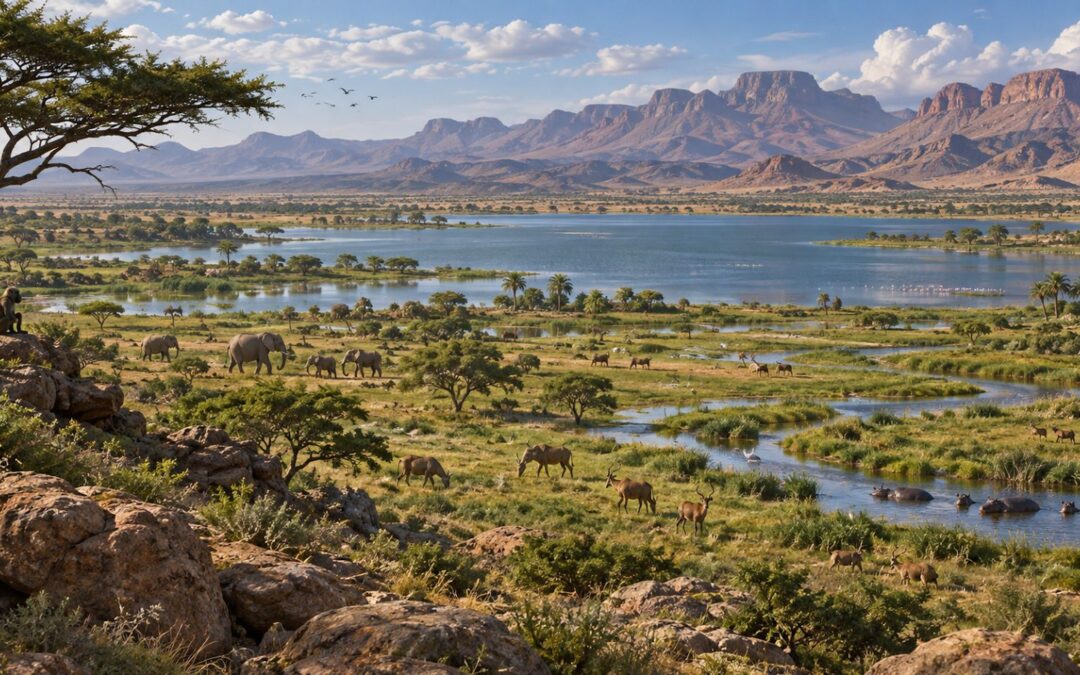
Today, southern Morocco is defined by dry valleys, rocky plateaus, desert plains, and landscapes where permanent surface water is often scarce. Travel through the Draa Valley, the Anti-Atlas, Tafilalt, or the approaches to the Sahara and it is easy to imagine that these environments have always looked this way.
The geological evidence tells a very different story. At different times in the past, North Africa experienced dramatic humid periods when rainfall increased, vegetation expanded, rivers became more active, and lakes occupied landscapes that are now dry.
During the best-known of these episodes, commonly called the African Humid Period, large parts of the Sahara changed from hyper-arid desert into a mosaic of grasslands, shrublands, wetlands, rivers, and lakes. Evidence from sediments, pollen, archaeological sites, animal remains, and ancient landscapes shows that people and wildlife occupied areas that today receive very little rainfall.
So, when was the Sahara green in Morocco?
The most recent major Green Sahara phase developed broadly after the end of the last Ice Age, with especially humid conditions between roughly 11,000 and 5,000 years ago across North Africa. But Morocco’s story is even older. Research in the Anti-Atlas has revealed an ancient lake near Tissint dating to approximately 60,000 to 50,000 years ago, evidence that northwestern Africa experienced earlier humid phases too.
The Sahara has therefore not switched between “desert” and “green” only once. It has changed repeatedly.
Understanding those changes transforms the way we see Morocco’s desert landscapes. Dry basins become former lake floors. Wadis become remnants of once more active drainage systems. Rock engravings showing cattle and wildlife begin to make greater environmental sense.
The desert we see today is only one chapter in a much longer Sahara climate history.
Table of Contents
What Do Scientists Mean by the Green Sahara?
The term Green Sahara describes periods when large areas of North Africa were much wetter and more vegetated than they are today. It does not mean that the entire Sahara became a tropical rainforest. The reality was more varied.
Depending on location and time, landscapes could include:
- grasslands
- savanna-like vegetation
- shrubs
- scattered trees
- wetlands
- seasonal rivers
- permanent or temporary lakes
- marshes
- better grazing environments
The best-known Green Sahara episode occurred during the early and middle Holocene and is usually associated with the African Humid Period Morocco was part of.
Across North Africa, stronger rainfall transformed environments that are now extremely arid. Research summarized by Nature describes the Sahara between approximately 11,000 and 5,000 years ago as containing extensive vegetation and lakes because of major changes in regional rainfall. Read the Nature overview of the Green Sahara.
But rainfall was not identical everywhere. Northwestern Africa sits at the meeting point of several climatic influences, including Atlantic systems, Mediterranean weather, and the West African monsoon. This makes prehistoric Sahara Morocco more complicated than simply applying a climate reconstruction from central or eastern Sahara directly to Morocco.
Why Did the Sahara Become Green?
The main explanation begins far beyond Morocco. It begins with Earth’s orbit.
Small Orbital Changes, Huge Climate Effects
Earth’s orbit and orientation change slowly over thousands of years. One important cycle is called precession. Precession changes the timing of the seasons relative to Earth’s position around the Sun.
During some periods of the past, Northern Hemisphere summers received more solar energy than they do today. Stronger summer heating over North Africa intensified atmospheric circulation. This helped strengthen the African monsoon and allowed rain-bearing systems to move farther north.
More rain reached regions that are now desert. Once vegetation began expanding, it could also reinforce the humid conditions. Plants reduced exposed dusty surfaces, affected evaporation, and changed how the land absorbed sunlight.
Lakes and wetlands expanded. A desert landscape gradually became greener.
Was All of Morocco Green at the Same Time?
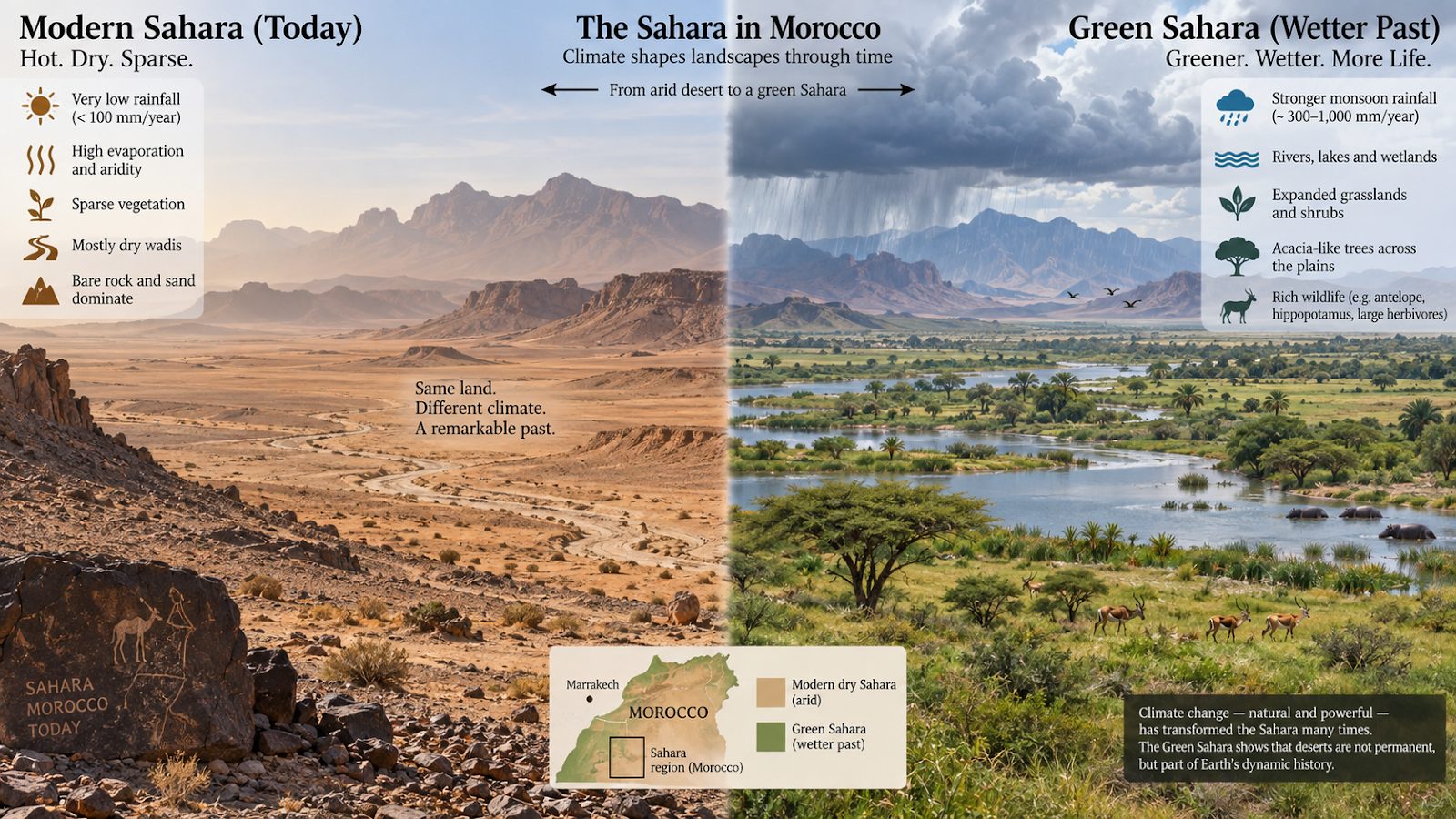
No. Climate varies strongly across Morocco even today. The Rif and northern Atlantic regions receive much more rainfall than the far southeast. Mountain ranges also influence where moisture falls.
The situation was similarly complex in the past. During humid phases, rainfall increased across large parts of North Africa, but the response of individual Moroccan regions depended on elevation, geography, moisture source, and local drainage.
The High Atlas and Middle Atlas preserve lake and pollen records that can reveal changes in rainfall and vegetation. Farther south, river deposits, old lake sediments, soils, tufa, and archaeological evidence provide clues from increasingly arid regions.
Instead of imagining one perfectly green Morocco, it is better to imagine climatic zones shifting. Grasslands could advance into areas that are desert today. Rivers could flow more regularly. Wetlands could appear in depressions. Lakes could occupy closed basins. Vegetation could spread along valleys and mountain fronts.
For geology travelers, these changes are especially interesting because the evidence is still preserved in the landscape. Atlas Geo Tours’ Geo Tours explore many of the desert, mountain, fossil, and sedimentary environments where Morocco’s long geological history can be read directly in the field.
Paleolake Tissint: Evidence of a Much Older Green Morocco
One of the most fascinating discoveries comes from the Anti-Atlas region of southern Morocco. Near Tissint, researchers studied sediments preserved in the Agadir-Tissint Feija, a broad lowland between mountain ranges.
Today, this landscape is arid. But the sediments record a very different environment. Scientists identified deposits created by an ancient lake, now known as Paleolake Tissint.
Modern dating indicates that the lake developed during a humid period beginning around 60,000 years ago and persisted, with climatic variations, until roughly 50,000 years ago. This is much older than the famous Holocene Green Sahara. It demonstrates that wetter conditions repeatedly returned to northwestern Africa during the Pleistocene.
What Was Paleolake Tissint Like?
The Agadir-Tissint Feija receives drainage from a catchment of several thousand square kilometers. When precipitation increased, rivers flowing from surrounding relief supplied water and sediment to the basin.
Instead of remaining the dry or intermittently flooded lowland seen today, the area supported a lake. Sedimentary layers record its development, fluctuations, and eventual disappearance.
Researchers used several dating and geological methods to reconstruct this history, including uranium-thorium dating, optically stimulated luminescence, sedimentology, and clay mineral analysis.
Their results connect Paleolake Tissint with a major period of increased summer solar radiation around 60,000 years ago. In other words, the same broad orbital mechanism that contributed to later Green Sahara periods was influencing the Moroccan Sahara long before the Holocene.
For readers who want to explore the scientific research directly, the 2024 study of Paleolake Tissint and the 60,000 to 50,000-year humid period provides one of the clearest Morocco-specific examples.
Morocco’s Ancient Rivers Were Also More Active
Lakes require water. That water must arrive somehow.
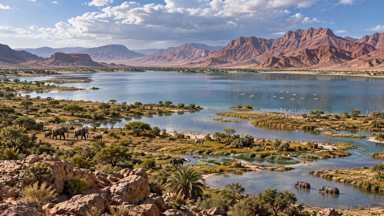
Across the Sahara, humid periods reactivated river systems that today may survive only as dry valleys, wadis, or buried channels. Some large prehistoric drainage networks are now detectable only through satellite imagery and sedimentary evidence.
In Morocco, the Draa River is especially important. The Draa is the major river system of southern Morocco and drains a vast region extending from the Atlas and Anti-Atlas toward the Saharan margin. Today, sections of the system experience strongly seasonal or intermittent flow.
In wetter periods of the past, however, the hydrological system was more active. River terraces, sediments, old soils, and floodplain deposits preserve evidence of repeated changes between stronger and weaker water flow. Recent research on the Middle Draa confirms that its sediments respond closely to regional climate variations over time.
A River Landscape That Constantly Changed
A river does not need to maintain the same channel for thousands of years. During wetter conditions, increased discharge can:
- widen channels
- erode older deposits
- build floodplains
- transport larger quantities of sediment
- connect basins
- recharge wetlands
- support more vegetation
During arid periods, water flow decreases. Wind becomes increasingly important. Sand can invade channels. Vegetation contracts toward oases and reliable water sources.
The modern Draa landscape is therefore the result of repeated interactions between water, wind, climate, and human activity.
Travelers can see parts of this changing geological corridor during Atlas Geo Tours’ 8-day Time Travel geological trip, which crosses the High Atlas toward Ouarzazate and follows the Draa Valley into fossil-rich southern Morocco.
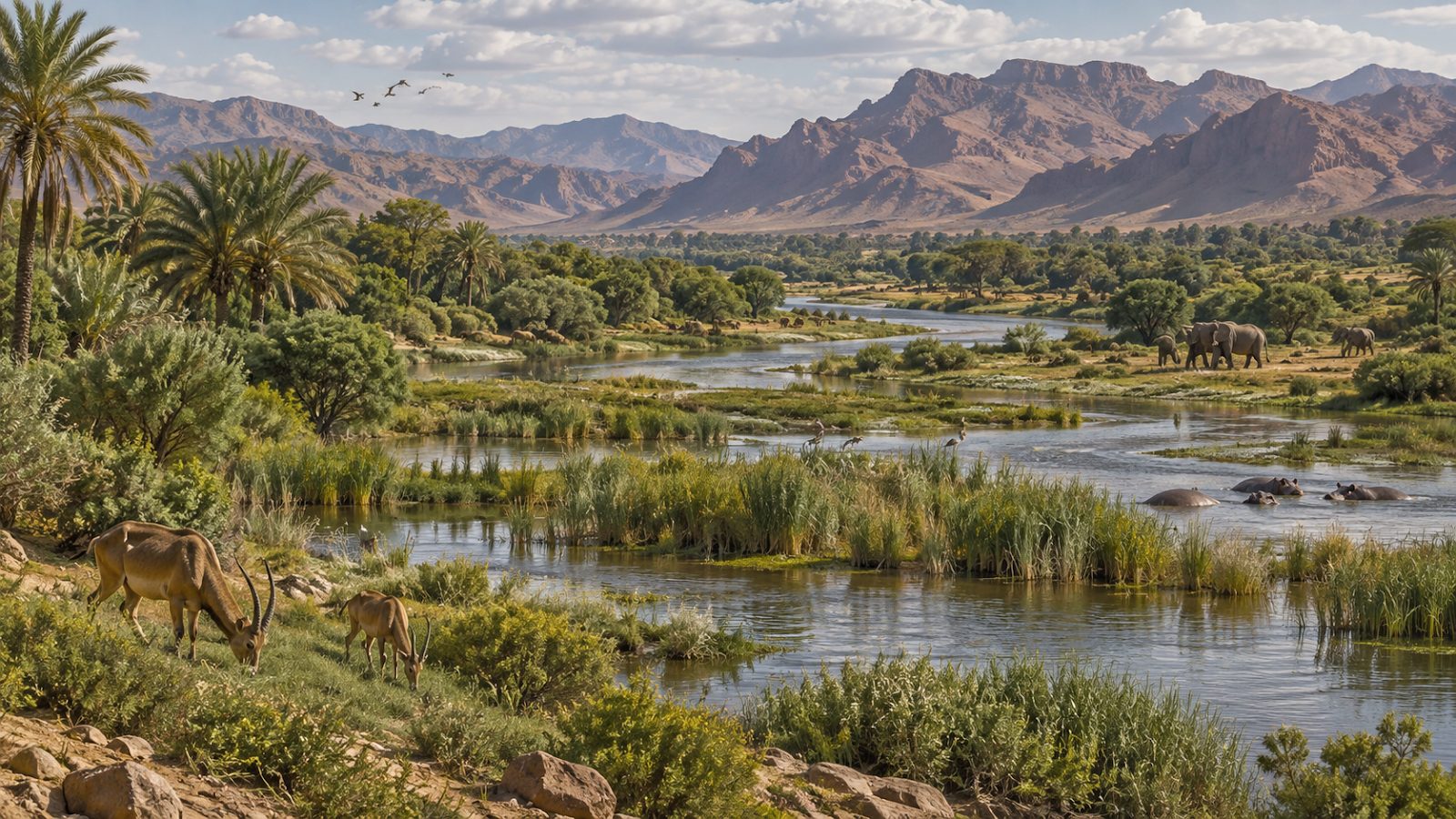
Follow the Draa Valley Through Time
8-Day Time Travel Fossils & Minerals Trip
Cross the High Atlas toward Ouarzazate and follow the Draa Valley into fossil-rich southern Morocco with Atlas Geo Tours.
Were There Really Lakes Across the Sahara?
Yes, although their size, duration, and age varied enormously. Ancient lake deposits occur throughout North Africa. During wetter periods, depressions that are dry today collected enough water to sustain lakes or wetlands. Some survived for long periods. Others appeared only during especially wet climatic phases.
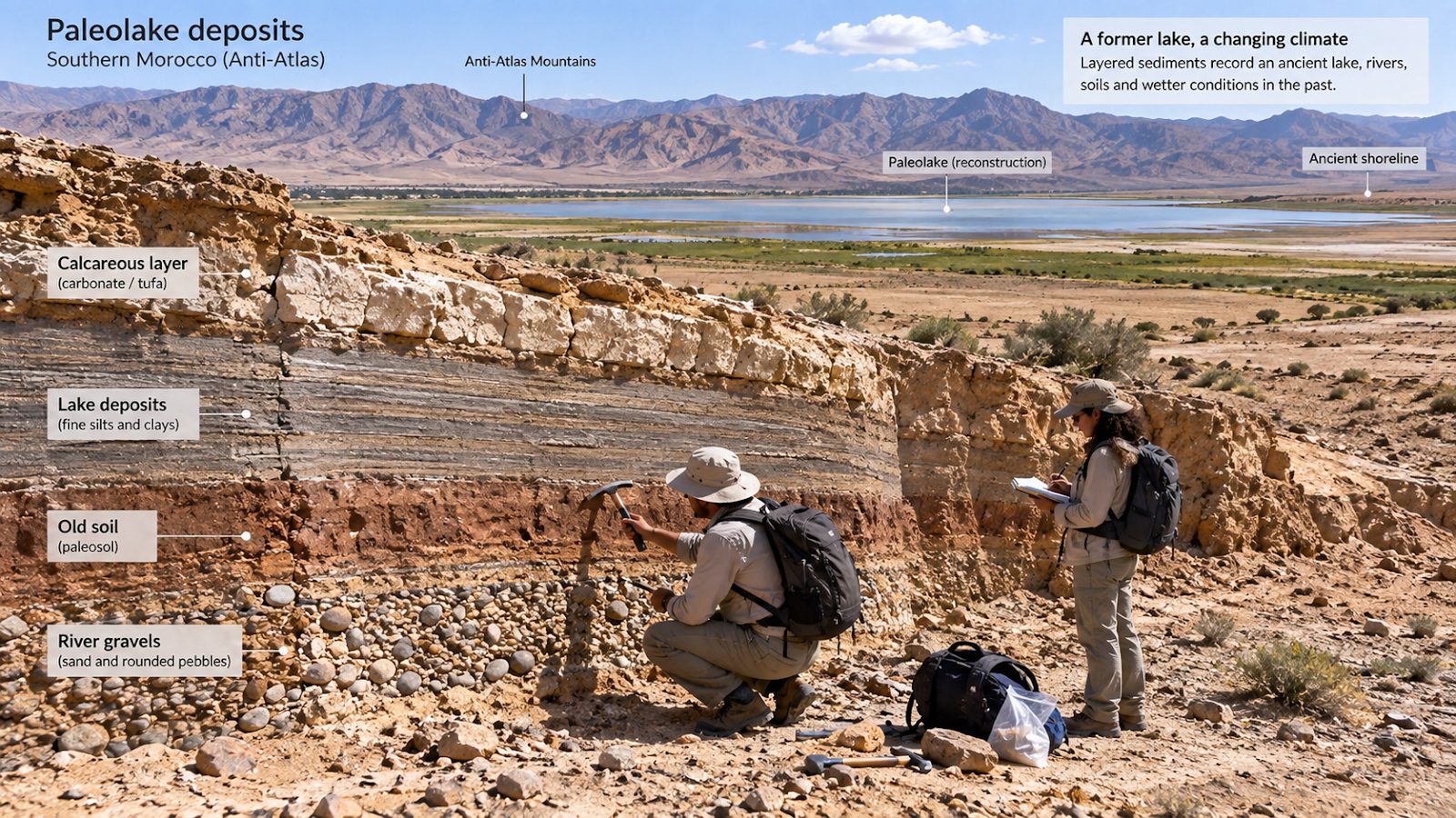
Scientists identify former lakes using evidence such as:
- fine lake sediments
- ancient shorelines
- freshwater shells
- diatoms
- carbonate deposits
- pollen
- fish remains
- aquatic fossils
- geochemical changes
- old river deltas
These archives can reveal much more than the simple presence of water. Pollen can indicate surrounding vegetation. Diatoms can reveal water conditions. Sediment chemistry can show changes in rainfall and evaporation. Shorelines can help estimate former lake levels.
Together, these clues allow geologists to reconstruct ancient lakes Sahara landscapes long after the water disappeared.
What Did the Green Sahara Look Like?
The popular image of a completely lush Sahara can be misleading. It probably looked different depending on where you stood.
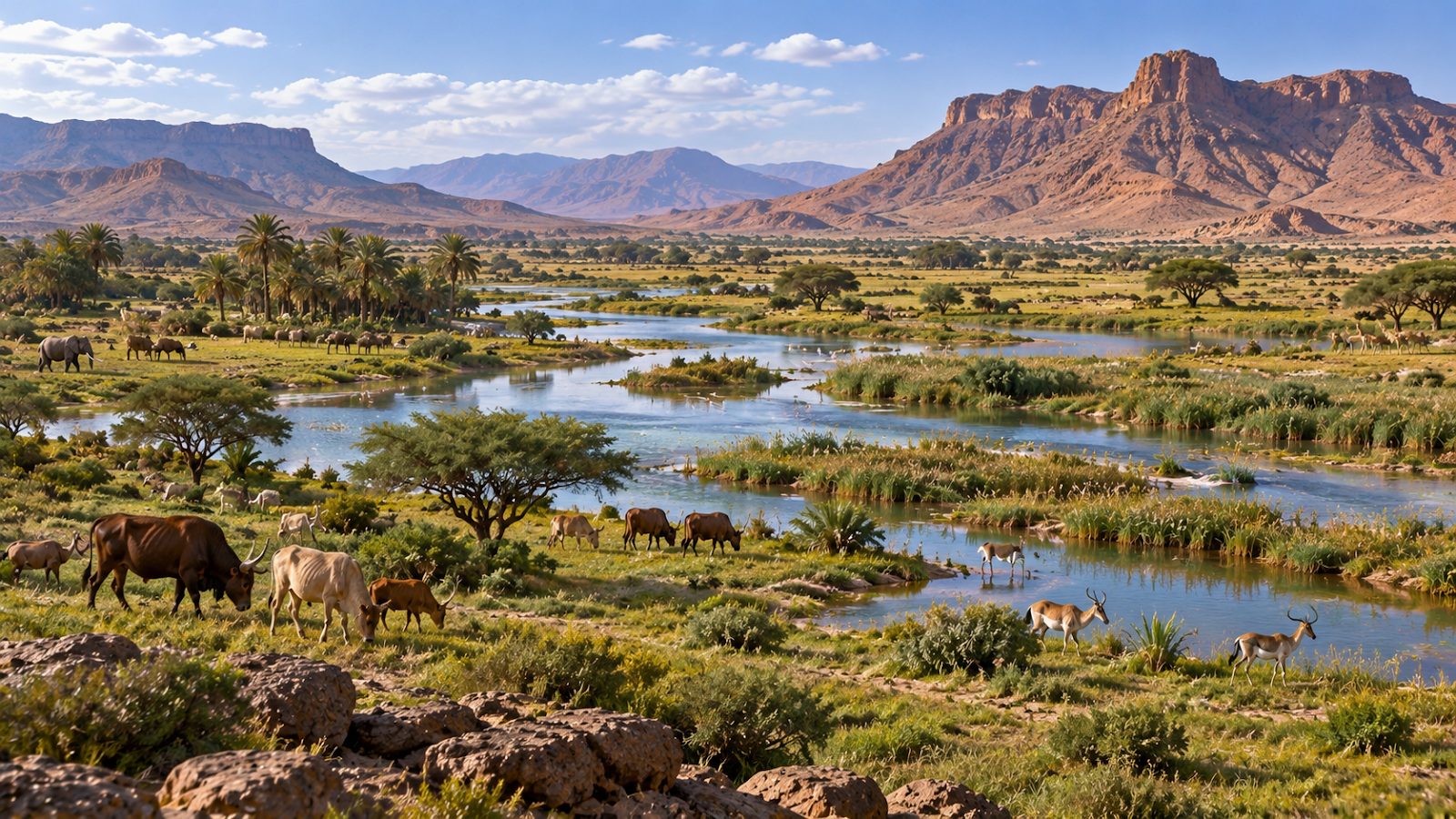
Some regions may have resembled open savanna. Others were dry grasslands interrupted by rivers and seasonal wetlands. Around lakes and reliable water, vegetation would have been denser. Wildlife could move through corridors that are impossible for many species today.
This environmental mosaic is important because people were also living in North Africa. Where water existed, animals gathered. Where animals gathered, hunters could follow. Later, pastoral communities could move cattle between grazing areas and reliable water sources.
The Sahara became a landscape of movement rather than the enormous climatic barrier we often imagine today.
Rock Art Gives Us a Human View of a Different Sahara
Geological evidence tells us about sediments, rainfall, vegetation, and rivers. Rock art gives us another perspective.
Across Morocco’s High Atlas and southern regions, prehistoric engravings depict animals, cattle, human figures, horses, camels, and other subjects. Some wildlife shown in Saharan rock art is associated with conditions very different from today’s hyper-arid desert.
Cattle imagery is particularly important because livestock require water and grazing. These images do not function as exact climate records. An engraving does not prove that a specific animal was standing at that exact location on the day the image was created.
But archaeological evidence and rock art support the wider picture of societies living within landscapes that changed dramatically through time. The transition from wild-animal scenes to pastoral imagery, horses, and eventually camels also reflects changes in human life and mobility across North Africa.
How Did People Live in a Greener Sahara?
Water changes everything. A wetter Sahara would have provided:
- drinking water
- fish
- wild animals
- grazing
- edible plants
- travel corridors
- temporary or permanent settlement areas
Archaeological research shows prehistoric occupation in Morocco’s Tafilalt and Draa regions, including Middle Paleolithic sites that demonstrate human use of environments now belonging to the Saharan zone.
Earlier humid episodes may have been especially important for human movement across Africa. A landscape containing connected lakes, rivers, grasslands, and wetlands is far easier to cross than thousands of kilometers of hyper-arid desert. This has led researchers to investigate whether Green Sahara periods created temporary migration corridors between sub-Saharan Africa, North Africa, and regions farther east.
The discovery of the 60,000 to 50,000-year humid episode at Tissint is particularly interesting because it overlaps with an important period of human dispersal. Researchers have proposed that wetter conditions may have created a climatic opportunity for movement through regions that later became much more difficult to cross.
Why Did the Green Sahara Disappear?
The same orbital processes that helped create wetter conditions eventually changed again. Northern Hemisphere summer solar energy decreased. The African monsoon weakened and shifted southward.
Rainfall across the Sahara declined. Vegetation contracted. Lakes became smaller. Wetlands disappeared. Rivers carried less water. Dust increased. The desert expanded.
The transition was not necessarily identical everywhere or perfectly synchronized. Some records indicate gradual environmental change. Others show more abrupt responses. Local water supplies, mountains, groundwater, and vegetation could allow certain places to remain habitable longer than surrounding regions.
But by roughly 5,000 years ago, much of the Sahara was moving toward the strongly arid conditions that characterize the region today.
Did People Cause the Sahara to Become a Desert?
Human land use may have influenced vegetation locally, but the major drying trend was driven primarily by large-scale climatic changes linked to orbital forcing and monsoon retreat.
This is important. The end of the African Humid Period was not simply the result of prehistoric people overgrazing an otherwise stable green landscape. The entire regional climate system was changing.
Human communities had to respond. Some moved toward rivers, mountains, coasts, and remaining lakes. Others adapted through changing subsistence strategies and pastoral mobility.
Why Morocco Did Not Simply “Dry Out” Once
One of the biggest lessons from Sahara climate history is that climate change was repetitive. The Sahara experienced several major humid periods during the Quaternary. The Holocene Green Sahara is simply the most recent famous example.
Morocco preserves evidence of earlier wet intervals too. The Paleolake Tissint record around 60,000 to 50,000 years ago is one example. Other northwestern African climate records document humid conditions during still earlier periods.
This means a dry landscape can contain evidence of several different lost worlds layered through time. An old lake bed might be tens of thousands of years old. A river terrace could belong to a different humid phase. Nearby archaeological material may represent another period entirely. Understanding the chronology is therefore essential.
How Do Scientists Reconstruct Morocco’s Lost Landscapes?
There is no photograph of the Green Sahara. Scientists reconstruct it by combining many types of evidence.
Lake Sediments
Fine layers accumulated at the bottoms of lakes can preserve pollen, minerals, microscopic organisms, and chemical signatures.
River Terraces
Old river deposits preserved above modern channels show where rivers once flowed and how active they were.
Pollen
Pollen grains can survive inside sediments for thousands of years. Different plants produce distinctive pollen, allowing researchers to reconstruct past vegetation.
Carbonate Deposits
Tufa and other freshwater carbonates can form where flowing groundwater or springs contain dissolved calcium carbonate. Their presence can indicate wetter hydrological conditions.
Speleothems
Stalagmites in caves grow when water moves through rock and enters underground chambers. Their chemistry can preserve records of rainfall and moisture sources.
Luminescence Dating
Optically stimulated luminescence can estimate when sediment grains were last exposed to sunlight before burial. This technique was important in dating parts of the Paleolake Tissint succession.
Archaeology
Stone tools, settlement traces, rock art, animal remains, and other archaeological evidence show how people responded to the changing environment.
The Modern Desert Still Preserves the Green Sahara
Once you know what to look for, the modern Sahara begins to look different. A flat depression may once have held water. A terrace above a wadi may record a stronger ancient river. Fine sediment exposed beneath gravel may belong to a former lake. Fossil roots can show where vegetation once stabilized the ground. Rock engravings may preserve animals connected with very different environments. Even some desert dunes record interruptions when wetter conditions allowed vegetation to grow.
These clues make geological field travel particularly rewarding. A landscape that first appears empty becomes filled with evidence.
Atlas Geo Tours specializes in journeys that approach Morocco through this deeper geological perspective, connecting the Geo Tours with fossil localities, desert environments, mountains, mines, and ancient sedimentary landscapes.
From Green Sahara to the Desert We Know Today
The modern Moroccan Sahara remains dynamic. Rivers still flood after exceptional rainfall. Dry lakes can temporarily hold water. Vegetation responds quickly where moisture becomes available. Oases survive because groundwater and river systems concentrate resources in specific places.
This does not mean the Green Sahara is returning. It does remind us that desert landscapes are not lifeless or completely static. They continue to respond to climate and water.
The difference is scale. During major African Humid Periods, the entire regional hydrological system shifted toward much wetter conditions for thousands of years. Today’s occasional storm is a short event. A Green Sahara represented a fundamentally different climatic state.
Exploring Southern Morocco as a Journey Through Climate History
Travel between Ouarzazate, the Draa Valley, Alnif, Erfoud, and Merzouga and you cross landscapes that preserve very different chapters of Earth’s history. Some rocks formed in prehistoric seas hundreds of millions of years ago. Fossils record ancient marine ecosystems. River sediments reveal changing rainfall. Desert surfaces preserve meteorites. Dunes record the work of modern winds. And paleolake deposits reveal times when the Sahara itself looked profoundly different.
Atlas Geo Tours’ multiday geological itineraries connect many of these environments, giving travelers the opportunity to experience Morocco’s geological history across the Atlas and Sahara rather than seeing each landscape in isolation.
At night, the desert adds yet another scale of time. Atlas Geo Tours’ stargazing experiences allow travelers to look beyond Earth’s climate history toward the planets, stars, and wider universe above the Sahara.
The modern desert may appear timeless. In reality, it is the latest stage of a constantly changing system.
Read Climate History Across the Atlas and Sahara
Multiday Geological Itineraries
Connect desert, mountain, fossil, and sedimentary environments in one journey instead of seeing each landscape in isolation.
What the Lost Lakes of Morocco Teach Us
The story of the Green Sahara Morocco preserves is powerful because it challenges something we often assume about landscapes. We tend to believe that what we see today is normal and permanent. Desert means desert. Mountains mean mountains. Dry river means dry river.
Geology shows us otherwise. Around Tissint, a dry Anti-Atlas basin once held a lake. Across southern Morocco, river systems responded repeatedly to wetter climates. During the Holocene African Humid Period, the wider Sahara supported vegetation, lakes, wetlands, animals, and human communities in places that today can appear almost empty.
Then the climate changed. Rainfall declined. Rivers contracted. Lakes disappeared. Wind became more important. The Sahara expanded again. And the evidence remained in the ground.
That is what makes the question when was the Sahara green in Morocco so fascinating. There is no single answer. Morocco experienced several humid phases, separated by long periods of aridity.
The most recent famous Green Sahara episode occurred broadly between about 11,000 and 5,000 years ago, but Moroccan geological evidence takes the story much farther back. Paleolake Tissint shows that a significant humid interval also transformed southern Morocco between roughly 60,000 and 50,000 years ago.
The Sahara has been green before. It has become desert again. And beneath today’s dry landscapes, the sediments of lost rivers and lakes still preserve the memory of those vanished worlds.
Look Beyond Earth’s Climate History
Stargazing Tours in the Sahara
At night, the desert adds another scale of time. Join Atlas Geo Tours’ stargazing experiences to look toward the planets, stars, and wider universe above the Sahara.
Frequently Asked Questions About the Green Sahara in Morocco
When was the Sahara green in Morocco?
The best-known recent Green Sahara phase occurred during the African Humid Period, broadly between approximately 11,000 and 5,000 years ago. Morocco also preserves evidence of older humid episodes, including Paleolake Tissint from roughly 60,000 to 50,000 years ago.
What was the African Humid Period?
The African Humid Period was a time when stronger rainfall transformed large parts of North Africa. Lakes expanded, rivers became more active, vegetation spread into areas that are desert today, and human populations occupied much of the Sahara.
Was the Moroccan Sahara once covered with grass?
Parts of the Moroccan Saharan and pre-Saharan zone likely supported significantly more vegetation during humid phases. The exact landscape varied by region and period, ranging from grasslands and shrublands to wetlands and better-vegetated river corridors.
Were there ancient lakes in Morocco’s Sahara?
Yes. Geological evidence confirms ancient lake environments in southern Morocco. Paleolake Tissint in the Anti-Atlas is an important example and records wetter conditions roughly 60,000 to 50,000 years ago.
Where was Paleolake Tissint?
Paleolake Tissint occupied part of the Agadir-Tissint Feija in southern Morocco, between the Anti-Atlas mountain front and Jbel Bani.
Did the Sahara have rivers?
Yes. During humid periods, river systems across the Sahara were much more active. Morocco’s Draa drainage system also records major changes in flow, sedimentation, and environmental conditions over time.
Why did the Sahara become green?
Changes in Earth’s orbital geometry increased Northern Hemisphere summer sunlight during certain periods. Stronger summer heating intensified African monsoon circulation and increased rainfall across North Africa.
Why did the Green Sahara become a desert again?
As orbital conditions changed, Northern Hemisphere summer solar energy decreased, the monsoon weakened and shifted southward, rainfall declined, and vegetation and lakes contracted.
Did the Green Sahara disappear suddenly?
Not everywhere. The timing and speed of drying varied by region. Some records show gradual drying, while others indicate faster environmental changes and periods of climatic instability.
Did people live in the prehistoric Moroccan Sahara?
Yes. Archaeological evidence documents prehistoric human occupation in southern Moroccan regions including the Tafilalt and Draa Valley. Wetter phases would have provided more water and biological resources than are available across much of the region today.
What animals lived in the Green Sahara?
Across North Africa, evidence indicates populations of animals associated with grasslands, wetlands, and better-watered environments. Rock art depicts cattle and diverse wildlife, although individual engravings must be interpreted carefully rather than treated as direct climate measurements.
How do scientists know ancient lakes existed?
Researchers identify lake sediments, freshwater organisms, mineral deposits, shorelines, pollen, geochemical signals, and other evidence. Dating techniques help establish when the lakes existed.
Can you still see evidence of the Green Sahara in Morocco?
Yes. Ancient lake deposits, old river terraces, paleosols, carbonate deposits, prehistoric archaeological sites, and rock art all preserve evidence of environmental conditions different from those of modern southern Morocco.
Can the Green Sahara return?
Earth’s orbital cycles continue, but today’s climate is also strongly influenced by human-caused global warming. The future Sahara cannot simply be predicted by repeating past orbital cycles, and a return of the prehistoric Green Sahara is not expected on any human travel timescale.
Explore Related Geology Tours in Morocco
Ready to see Morocco’s geology in person? These Atlas Geo Tours combine fossils, minerals, mountains, and dramatic landscapes.


