
How Were the Erg Chebbi Dunes Formed? The Science Behind Morocco’s Giant Star Dunes
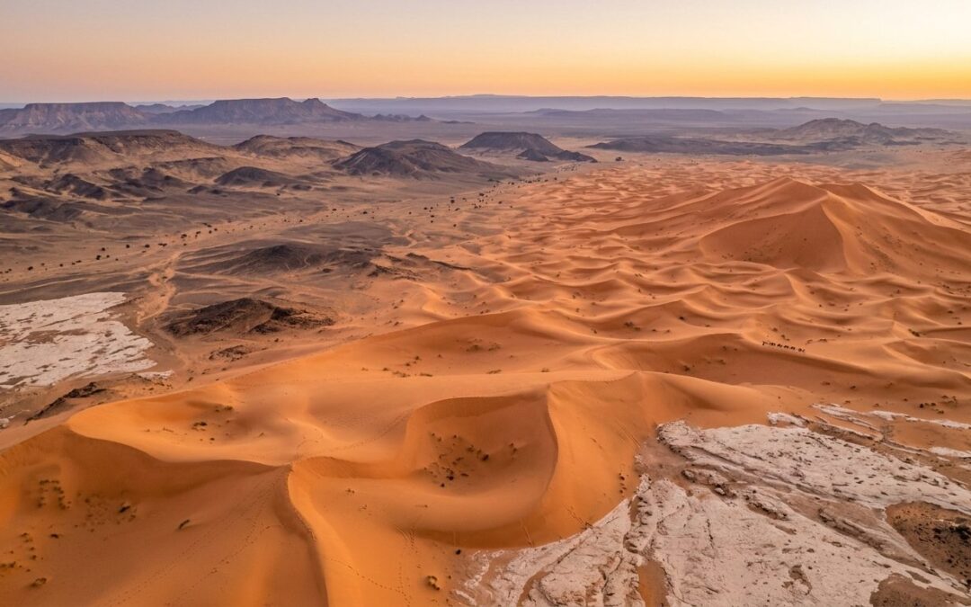
The dunes of Erg Chebbi are among the most recognizable landscapes in Morocco.
Rising suddenly from the rocky desert near Merzouga, these immense orange dunes appear almost permanent. Their high crests, changing shadows, and smooth slopes give the impression of mountains made from sand.
But Erg Chebbi is anything but static.
Every grain has been transported by wind. Dune ridges shift. Sand moves from one slope to another. Some dunes migrate slowly across the landscape, while others grow upward as winds arrive from different directions.
Recent scientific research has revealed an even more surprising story.
One of the most important Erg Chebbi star dunes, known as Lala Lallia, contains sediments more than 10,000 years old near its base. Yet much of the giant dune visible today developed during only the last 1,000 years. Researchers also discovered that the dune continues to migrate slowly westward.
Understanding how were Erg Chebbi dunes formed therefore means looking beyond the beautiful surface.
Their story involves changing winds, periods of wetter climate, ancient stabilized sand, sediment accumulation, erosion, and the extraordinary behavior of star dunes.
For travelers interested in geology, Erg Chebbi is not simply a place to watch the sunset. It is a living geological landscape where wind is still building and reshaping the desert today.
What Exactly Is Erg Chebbi?
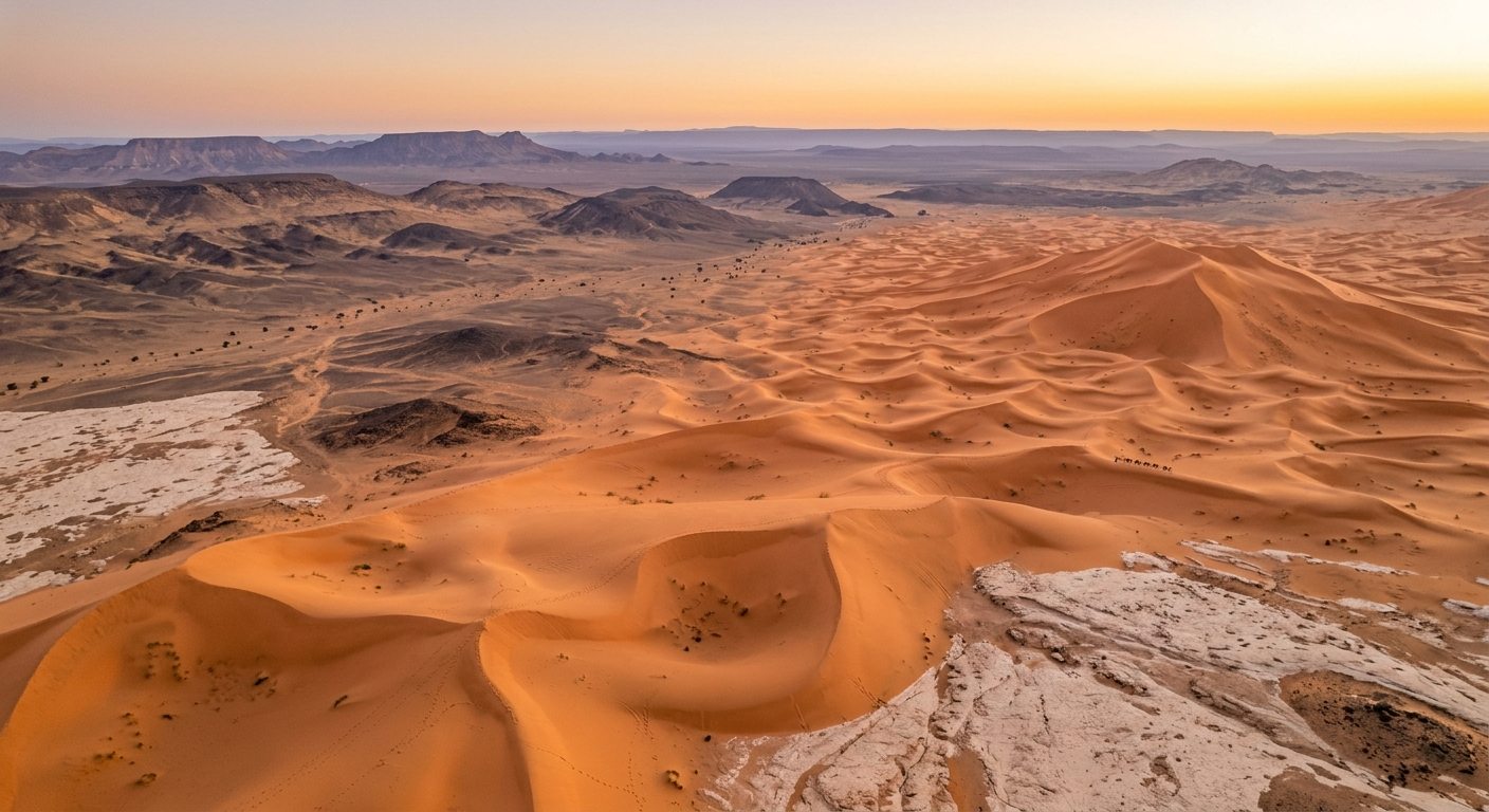
The word erg describes a large area dominated by wind-blown sand and dunes, often called a sand sea.
Erg Chebbi lies in southeastern Morocco near Merzouga, close to the Algerian border and within the wider Tafilalt region.
Unlike the enormous sand seas found deeper inside the Sahara, Erg Chebbi is relatively compact. Scientific mapping used in the Lala Lallia study describes the erg as approximately 18 kilometers long and 9 kilometers wide.
Yet within that relatively limited area, the dunes can reach impressive heights.
The sand sea contains several types of dunes, including reversing barchanoid forms and large complex star dunes. NASA satellite and astronaut observations also show multiple pyramid-shaped or star dunes rising prominently within Erg Chebbi.
Around the dunes lies a very different environment.
Rocky hammada, dry plains, ephemeral river systems, mountains, and ancient geological formations surround the bright sand.
That contrast is one of the first clues to understanding Erg Chebbi geology.
The dunes did not appear independently from the landscape around them. They developed within a larger basin where wind and water have transported and redistributed sediment over long periods.
How Were the Erg Chebbi Dunes Formed?
At the simplest level, dunes form when wind transports loose sand and then deposits it.
But that explanation does not fully describe Erg Chebbi.
For a dune field to develop, several things are necessary:
- a supply of loose sand
- wind strong enough to move it
- areas where sand can accumulate
- enough time for dunes to grow
- wind patterns that determine the dune shapes
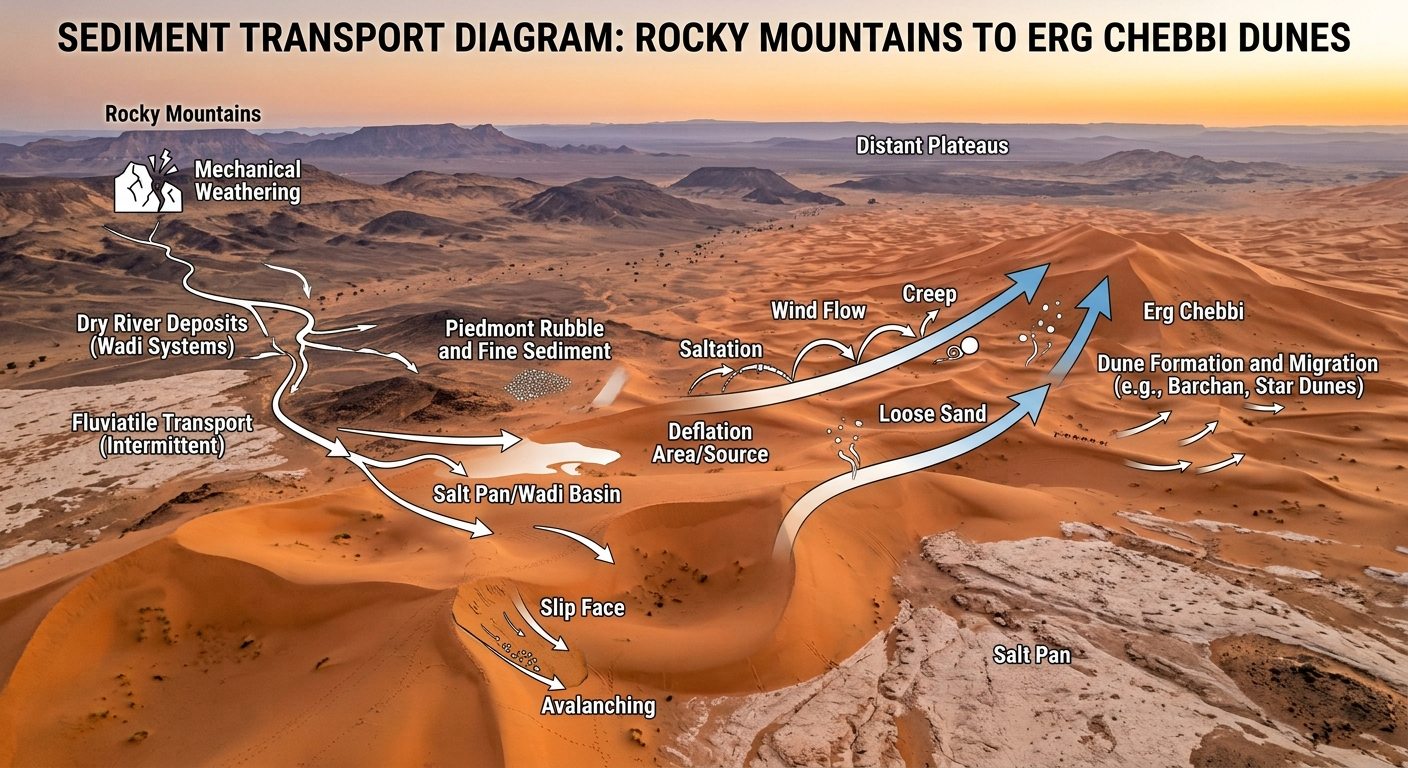
A sand grain can move across the surface through several processes.
Some grains roll or slide.
Others bounce repeatedly in a process known as saltation.
When moving grains collide with the ground, they can knock additional grains into motion.
Eventually, wind speed decreases or the airflow changes around an obstacle or dune. Sand is deposited.
Over thousands of repeated events, small accumulations can become large dunes.
At Erg Chebbi, however, the direction of the wind is especially important.
The region experiences winds arriving from more than one direction. This creates conditions suitable for the formation of complex star dunes rather than simple dunes that migrate primarily in one direction.
Where Does the Sand of Erg Chebbi Come From?
This is one of the most interesting questions about the formation of Erg Chebbi dunes.
Desert sand is not created simply because a place is dry.
The grains must come from somewhere.
The Tafilalt Basin surrounding Erg Chebbi contains Paleozoic rocks, younger sedimentary formations, extensive alluvial deposits, and material transported by ephemeral river systems such as the Ziz and Rheris. Research on the geomorphology of the basin shows a close relationship between river deposits and many dune systems in southeastern Morocco.
Rivers can therefore play an indirect role in building deserts.
During wetter episodes, water carries sediment downstream.
When river channels dry or floodplains become exposed, wind can pick up the finer sandy fraction and transport it again.
The same grain may therefore have experienced several different stages of travel.
It may have been eroded from rock.
Then moved by water.
Deposited on a plain.
Picked up by wind.
And finally incorporated into a dune.
Research around Erg Chebbi indicates that sediment sources and wind transport patterns are complex, which means it is better to think of the sand sea as part of a connected desert system rather than a simple pile of sand arriving from one single direction.
Travelers interested in seeing the geological environments surrounding the dunes can explore Atlas Geo Tours’ North Erg Chebbi Geological Day Trip, which moves beyond the sand itself into the wider fossil-bearing and geological landscapes of the Tafilalt region.
Why Are Some Erg Chebbi Dunes Shaped Like Stars?
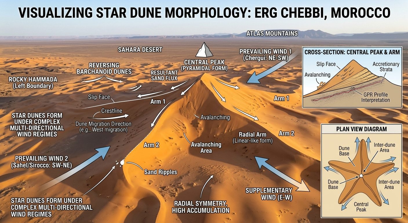
The most spectacular features of Erg Chebbi are its star dunes.
From ground level, a large star dune can resemble a pyramid or enormous sand mountain.
From above, the reason for the name becomes clearer.
Several ridges or “arms” extend outward from a central high point, producing a shape that resembles a star.
Star dunes usually develop where winds arrive from several directions.
This is different from a simple barchan dune.
A crescent-shaped barchan generally forms where one dominant wind direction controls sand movement.
A star dune forms in a more complicated wind environment.
At Erg Chebbi, the wind regime includes strong flows from the southwest and northeast, together with additional easterly influence. As wind direction changes, different sides of the dune become active. Sand is pushed toward different arms while also accumulating vertically near the main dune body.
This is how a dune can grow extremely high without simply traveling rapidly across the desert as one coherent shape.
The wind continually rebuilds it.
One arm may migrate in one direction.
Another responds differently.
The crest can reverse.
Sand can be removed from one slope and deposited on another.
The entire dune becomes a dynamic structure shaped by competing winds.
Lala Lallia: The Star Dune That Changed What Scientists Knew
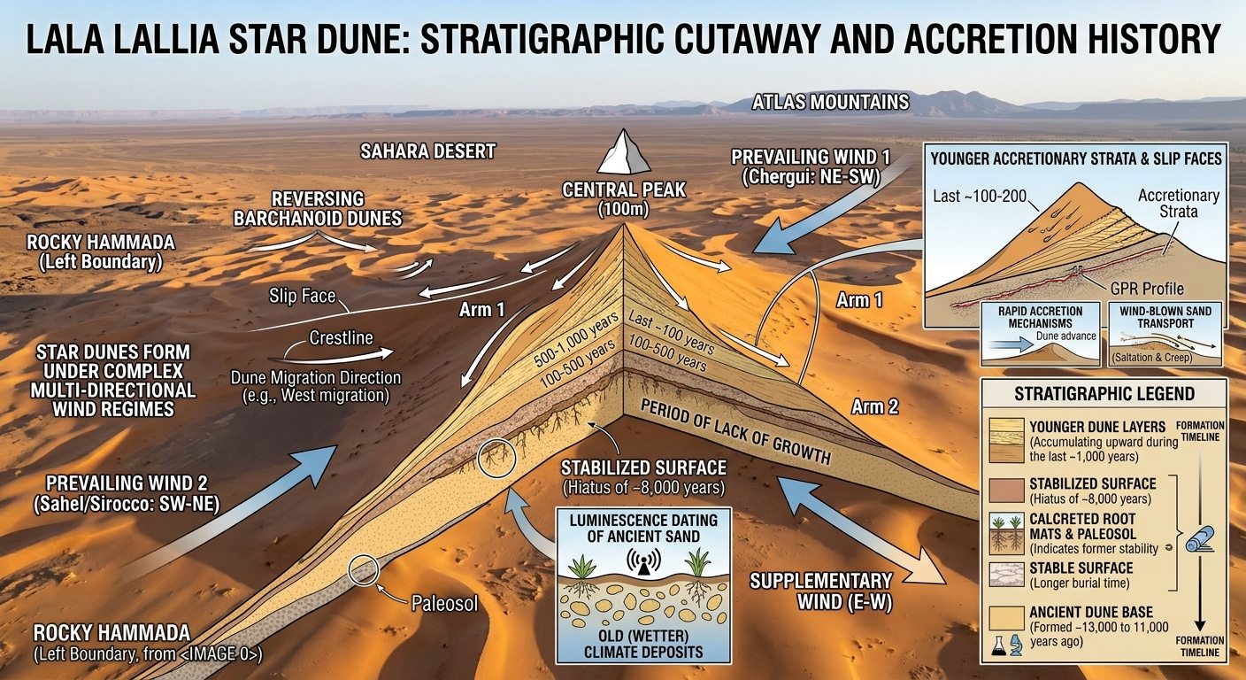
In 2024, researchers published a detailed study of a major Lala Lallia dune at Erg Chebbi.
The dune is approximately 100 meters high and 700 meters wide.
Its name has been translated as “highest sacred point,” and its enormous form made it an ideal location for investigating how star dunes develop internally.
Scientists used two particularly important methods.
Ground-Penetrating Radar
Ground-penetrating radar, often abbreviated as GPR, allows researchers to examine structures beneath the surface without excavating the entire dune.
Radar signals travel into the sand and reflect from internal boundaries.
These reflections reveal layers created as older dunes migrated, slopes changed, and new sand accumulated.
Instead of seeing only the external shape, scientists could effectively examine the internal architecture of Lala Lallia.
Optically Stimulated Luminescence Dating
The second important method was optically stimulated luminescence, or OSL dating.
Quartz grains can store energy after they are buried.
Exposure to sunlight resets this natural signal.
By measuring the stored energy in carefully collected sand samples, researchers can estimate when the grains were last exposed to daylight before burial.
This does not tell scientists when the individual quartz grain originally formed.
That grain may be millions or even billions of years old.
Instead, OSL helps determine when the sand was deposited inside the dune.
The results revealed a much more complicated history than the dune’s modern appearance suggests.
Readers who want to explore the published scientific study directly can consult the research on the structure and chronology of the Erg Chebbi star dune in Scientific Reports.
Is Erg Chebbi Really Thousands of Years Old?
Yes, but the answer depends on which part of the dune you mean.
Samples near the base of Lala Lallia produced ages of roughly 13,350 years, 12,160 years, and 9,530 years.
Then something changed.
The sedimentary record contains a long gap lasting approximately 8,000 years.
During that interval, active accumulation largely stopped at the studied location.
The surface became stabilized.
Researchers found evidence including ancient root traces, indicating that vegetation existed where we now see an enormous desert dune.
This occurred during a period when North African climate was significantly wetter than today.
Then dune-building resumed.
Much of the upper structure of Lala Lallia accumulated surprisingly recently.
The study found that the upper 65 meters formed during approximately the last 1,000 years. Some dune-arm sediments were only decades old.
This means the answer to “How old is Erg Chebbi?” cannot be reduced to a single number.
There is old sand at the base.
There was a long period of stability.
Then a giant modern star dune developed above it.
Discover Morocco’s Geological Treasures
Explore the Sahara, fossils, minerals, and unique geological landscapes with an expert-led journey.
What Happened During the 8,000-Year Gap?
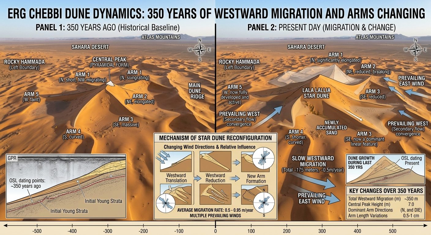
The gap in dune accumulation connects Erg Chebbi to one of the most important climatic episodes in recent Saharan history.
During parts of the early and middle Holocene, North Africa experienced wetter conditions than today.
This period is commonly associated with the African Humid Period.
Areas now dominated by desert supported more vegetation, water bodies, and human activity.
At Lala Lallia, the evidence suggests that sand accumulation paused and the surface became stabilized during this wetter interval.
Researchers identified features including rhizoliths, which are structures associated with former plant roots.
They also found evidence of thunderstorms and human activity at the old stabilized surface.
As climatic conditions later became more arid and the wind regime changed, active dune construction resumed.
This makes Erg Chebbi valuable for more than studying modern desert scenery.
Its internal layers preserve information about changing environments.
The dunes are effectively an archive of climate and wind.
How Did Lala Lallia Grow So Quickly?
A 100-meter dune sounds ancient.
Yet the research shows that much of Lala Lallia reached its present scale surprisingly quickly in geological terms.
The answer lies in net sand accumulation combined with multidirectional winds.
When winds repeatedly move sand toward a particular area, the dune gains sediment.
At the same time, winds from changing directions reshape different slopes and arms.
Sand does not simply move horizontally.
It is repeatedly pushed upward through the dune system.
This vertical accumulation is a defining feature of large star dunes.
The top also remains extremely active.
Wind accelerates as it approaches the crest, and the smaller amount of sand at the highest part makes the crest easier to reshape.
A dune can therefore look monumental and permanent while its highest ridges remain highly dynamic.
Do the Erg Chebbi Dunes Move?
Yes.
The answer is important because people often think star dunes remain fixed because they are so large.
Measurements and dating from Lala Lallia show that the dune is migrating generally toward the west.
Researchers calculated an average movement of approximately 0.55 meters per year during the studied period, with individual estimates varying.
Half a meter does not sound dramatic when observed during a single visit.
Over a century, however, that becomes around 50 meters.
Dune arms can be even more active at shorter timescales.
Measurements of crest positions showed that some sections shifted by several meters over relatively short periods, although movement varied greatly around different parts of the dune.
This is one reason dunes can affect roads, settlements, agricultural land, and infrastructure.
They are landscapes in motion.
The Chergui, Sirocco and the Winds That Shape Erg Chebbi
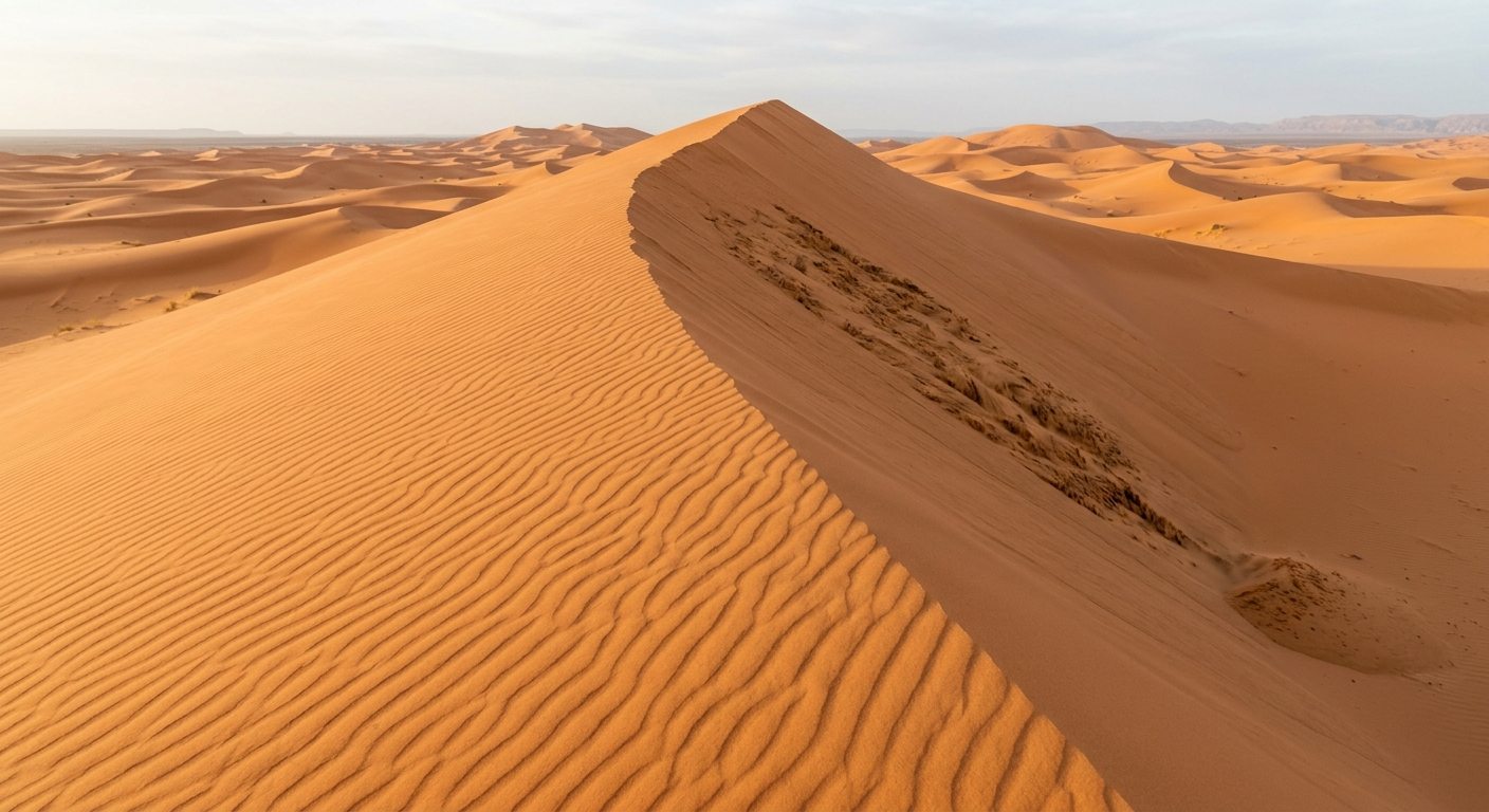
Wind is the architect of Erg Chebbi.
The scientific study of Lala Lallia describes a largely bimodal wind regime.
One important wind blows broadly from southwest toward northeast.
Another, associated with the Chergui, approaches from the opposite northeastern direction.
There is also an additional easterly component.
These changing directions explain the complexity of the dune.
If only one wind dominated continuously, the dunes would tend to develop simpler forms aligned with that transport direction.
At Lala Lallia, alternating winds interact with the existing dune shape.
The dune itself modifies airflow.
Wind is deflected around its flanks.
Some arms are more exposed to one wind than another.
As a result, different sections can migrate independently.
This interaction between topography and airflow is what gives Morocco star dunes their extraordinary architecture.
What Happens to Sand on the Steep Side of a Dune?
A dune has two very different kinds of slopes.
On the windward side, wind pushes sand upward.
Grains bounce and roll toward the crest.
Eventually, they reach a point where the slope on the opposite side becomes too steep to remain stable.
Then sand falls.
This steep downslope surface is called a slip face.
Small avalanches repeatedly move sand down the slip face.
Each avalanche creates another layer.
Over time, thousands of these events build inclined internal beds known as cross-strata.
These layers are extremely important to geologists because similar structures can be preserved after ancient dunes harden into sandstone.
The internal structure of Lala Lallia showed large sets of cross-strata and multiple bounding surfaces related to dune arms, migration, and changing wind directions.
Why Do Geologists Study Modern Dunes?
Modern dunes help geologists understand ancient rocks.
Imagine an old desert dune buried by younger sediment.
Over millions of years, the sand can become sandstone.
The original dune disappears from the landscape, but some of its internal layers remain preserved inside the rock.
Geologists can examine those layers and reconstruct the ancient environment.
They may be able to determine:
- dominant wind directions
- dune migration
- desert conditions
- sediment supply
- changes in climate
- ancient landscape orientation
Star dunes have created a scientific puzzle.
They are common enough in modern deserts, yet geologists have rarely identified convincing ancient star-dune deposits in the rock record.
The Lala Lallia study suggests one reason.
When only small exposures are visible, individual layers from a star dune can resemble deposits created by simpler dunes.
Understanding the complete internal architecture of a modern star dune provides geologists with a better model for recognizing similar structures in ancient sandstone.
Erg Chebbi Is Part of a Much Larger Geological Landscape
The dunes are visually dominant, but they are only one chapter in the geology surrounding Merzouga.
The wider Tafilalt region contains rocks from very different geological periods.
To the south and east lie Cretaceous formations associated with the Kem Kem region.
Elsewhere are Devonian, Silurian, Carboniferous, and other sedimentary units famous for fossils.
Old mining areas, rocky hammadas, dry river systems, and desert plains surround the erg.
This means a traveler can move from extremely old consolidated rocks into a very young and actively changing dune landscape during the same day.
Atlas Geo Tours’ South Erg Chebbi Geological Day Trip explores this wider setting through old mines, Cretaceous and Devonian beds, and fossil-bearing locations around the desert.
For a broader introduction to Morocco’s geological experiences, the Atlas Geo Tours Geo Tours collection includes field trips focused on fossils, minerals, rock formations, and desert geology.
Can You See the Geology of Erg Chebbi During a Visit?
Yes. You do not need ground-penetrating radar to notice that Erg Chebbi is an active landscape.
Look closely and the dunes reveal movement everywhere.
Fresh ripples record recent winds.
Sharp ridges indicate active sand transport.
Different slopes face different directions.
Some areas contain vegetation that traps sand.
Elsewhere, wind strips sand away and exposes darker surfaces.
After strong winds, footprints and vehicle tracks can disappear surprisingly quickly.
This is one of the best ways to appreciate Merzouga dune geology.
Instead of seeing only a beautiful desert, start asking questions.
Why is this ridge here?
Which direction did the wind blow?
Why is one slope gentle and the other steep?
Why do the dunes stop suddenly against the rocky plain?
Once you begin reading these patterns, the landscape becomes much more interesting.
Sunrise and Sunset Reveal the Shape of the Dunes
Light can help visitors understand dune structure.
Near midday, bright sunlight can make slopes look flat because shadows are limited.
During early morning and late afternoon, low-angle sunlight creates dramatic contrasts.
One dune face becomes illuminated.
The opposite face falls into shadow.
Small ripples become visible.
Crests and arms become easier to distinguish.
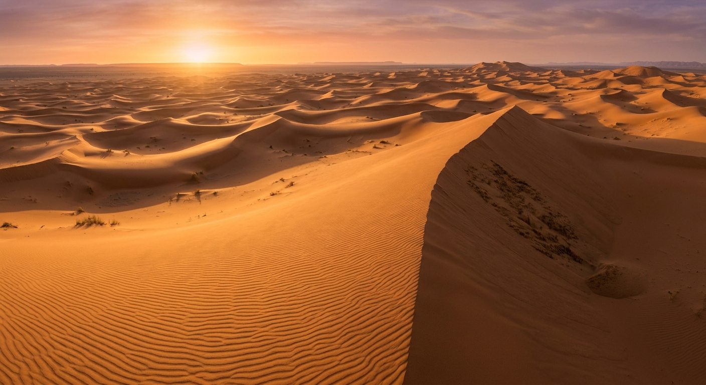
This is why sunrise and sunset are not only beautiful times to photograph Erg Chebbi. They are also excellent times to observe its geomorphology.
A wide view from an elevated dune can reveal the relationship between large star dunes and smaller forms surrounding them.
Exploring Erg Chebbi Beyond the Geology
Understanding dune formation does not remove the sense of wonder from Erg Chebbi.
It adds another layer to it.
Visitors can still experience camel journeys, desert camps, sunrise walks, local communities, and nights under dark skies.
Atlas Geo Tours includes Erg Chebbi within several longer journeys, including its 5-day desert tour from Marrakech to Erg Chebbi, which combines the High Atlas, Draa Valley, Merzouga, the dunes, fossil-related stops, and other southeastern landscapes. The dunes also provide a natural setting for astronomy.
Once the Sun disappears, the landscape that was shaped by wind becomes a foreground for the night sky.
Atlas Geo Tours’ astronomy and geology field trip includes Erg Chebbi, fossil exploration, geological landscapes, and guided sky observation. This combination is particularly appropriate at Erg Chebbi.
During the day, the dunes record wind and climate.
At night, the desert opens toward the wider universe.
Why Erg Chebbi Is More Than a Famous Desert View
Erg Chebbi looks timeless.
Science shows that it is not.
The sand sea is constantly being reshaped.
Its star dunes respond to winds arriving from multiple directions.
Their arms extend, reverse, and migrate.
Sand climbs toward high crests and falls down slip faces.
The landscape visible today is only one moment in a continuing geological process.
Lala Lallia makes that story especially clear.
Its deepest studied sediments preserve evidence from more than 10,000 years ago.
Then the surface stabilized during a wetter climatic period.
Thousands of years passed with little dune accumulation.
Later, increasingly arid conditions and a changing wind regime allowed a giant star dune to rise.
Much of its upper structure formed within roughly the last millennium.
And it is still moving today.
That is what makes the question how were Erg Chebbi dunes formed so fascinating.
There is no single moment when the dunes appeared.
They are the result of repeated interactions between sand, wind, water, climate, vegetation, and time.
When travelers stand on the crest of Erg Chebbi and watch the wind erase their footprints, they are watching the same process that has been constructing this landscape grain by grain for centuries.
The dunes are not finished.
They are still being made.
Frequently Asked Questions About Erg Chebbi Dune Formation
How were Erg Chebbi dunes formed?
Erg Chebbi formed through the long-term transport and accumulation of wind-blown sand. Winds from multiple directions created complex dune forms, including giant star dunes. Sediment supply, changing climate, and the surrounding basin also influenced the development of the sand sea.
What is a star dune?
A star dune is a large, pyramid-like dune with several arms extending from a central high point. It forms where winds arrive from multiple directions and sand continues to accumulate.
Is Erg Chebbi a star dune?
Erg Chebbi is a sand sea containing several types of dunes. Some of its most prominent features are large complex star dunes, including Lala Lallia.
What is Lala Lallia?
Lala Lallia is a major star dune within Erg Chebbi near Merzouga. The studied dune is approximately 100 meters high and 700 meters wide and has been the subject of detailed research into star-dune formation.
How old are the Erg Chebbi dunes?
The answer depends on the part of the dune being studied. Sand near the base of Lala Lallia has been dated to more than 10,000 years ago, but much of its upper structure accumulated within approximately the last 1,000 years.
How do scientists date sand dunes?
Researchers can use optically stimulated luminescence dating. The method estimates when quartz grains were last exposed to sunlight before being buried inside the dune.
Do the Erg Chebbi dunes move?
Yes. Lala Lallia is migrating generally westward at an average calculated rate of roughly half a meter per year, although individual dune arms and crests can move differently.
Why are Erg Chebbi dunes orange?
The warm color comes from the mineral composition and surface coatings of the sand grains, especially iron-bearing minerals that can produce reddish, orange, and golden tones. Lighting at sunrise and sunset makes these colors appear even stronger.
Where does the sand in Erg Chebbi come from?
The sand is part of a larger sedimentary system involving erosion, alluvial transport, exposed sediments, and wind redistribution within the Tafilalt Basin. Research shows strong links between fluvial and aeolian processes across southeastern Morocco, although Erg Chebbi’s precise sand-source history is complex.
Why did dune formation stop for thousands of years?
Evidence from Lala Lallia indicates a long period of stabilization associated with wetter Holocene conditions. Vegetation helped stabilize the surface before large-scale dune accumulation resumed later.
What winds shape Erg Chebbi?
The dunes are influenced by winds from several directions, including opposing northeast and southwest flows and an additional easterly influence. This multidirectional wind regime helps produce star-dune forms.
Are the dunes around Merzouga still changing?
Yes. Wind continues to transport sand, move crests, reshape dune arms, form ripples, and alter slip faces. Erg Chebbi is an active landscape rather than a fixed geological monument.
Can you explore Erg Chebbi on a geology tour?
Yes. Atlas Geo Tours offers geological day trips around both the northern and southern Erg Chebbi region, as well as longer itineraries combining Merzouga with fossils, mines, desert geology, and astronomy.